
Leaders in the industry
Aerial photogrammetry
Photogrammetry is a mapping technique that uses drones equipped with RGB cameras to capture aerial images and create 3D digital terrain models. This technology is central to modern surveying, offering a fast and accurate way to map large areas of land.
Play Video
Aerial Photogrammetry
Orthophotos and point clouds with centimetre accuracy.
Drone photogrammetry represents a significant advance in modern surveying. At Octocam Maps, we have perfected this service to offer detailed and accurate solutions. Our autonomous drones are equipped to cover vast areas, providing accurate and reliable three-dimensional data.
Technical specifications:
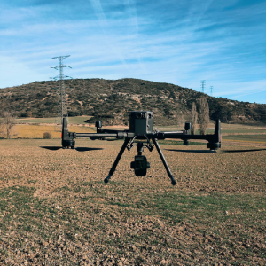
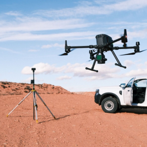
Our drones are programmed to fly autonomously over designated areas, capturing images at regular intervals to ensure the necessary overlap for accurate reconstruction. Using PPK and RTK technologies, our equipment can map up to 200 hectares per day, delivering data with centimetre accuracy. The result is a detailed point cloud, followed by a mesh and finally a textured mesh.



Octocam Maps aerial photogrammetry experts
Advantages of drone photogrammetry.
Broad Coverage
Capable of mapping up to 200 hectares per day, our drones offer extensive and efficient coverage.
Detailed Data
We produce point clouds, meshes and textured meshes for a complete and accurate three-dimensional representation.
Various applications
From surveying to the generation of virtual environments, our technology is adaptable to multiple uses.
Top #1 engineers
Experts in LiDARMappingPhotogrammetryTopographyMultispectralOrthophotosInspectionsScan to BIMLaser ScannerSoftware
Contact
What do you need?
Contact us.

What do you need?
Newsletter
Subscribe to our newsletter and discover the latest product updates and industry news
Octocam-Maps © 2024