
Leaders in the industry
LiDAR Drone
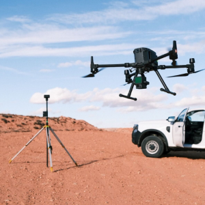
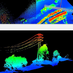
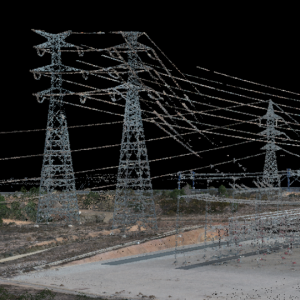
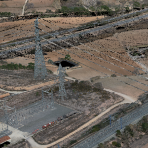
The Lidar Drone is an aerial mapping technology that uses a laser system to measure distances between the drone and the ground. Create accurate 3D point clouds of the terrain thanks to the RTK system that guarantees stability in the coordinates during the flight. Essential for capturing high-resolution geographic data.
Play Video
LiDAR by Octocam-maps on Sketchfab
LiDAR Drone
Efficiency and precision.
At Octocam Maps, we carry out aerial mapping with our advanced RGB camera lidar system onboard a drone. This method offers an efficient and accurate alternative to traditional aerial mapping methods. It is capable of mapping up to 120 Ha in a single day.
Technical specifications:
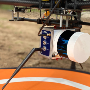
Our Lidar Drone uses a system based on the measurement of laser distances and intensities, collected in flight along defined trajectories. Assisted by GPS and an inertial system, we accurately determine the position and orientation of the sensor. This integration of technologies allows us to generate detailed point clouds in planimetry and altimetry with a centimetric accuracy of ±5 cm, covering up to 150 hectares per day.
Octocam Maps LiDAR experts
Advantages of LiDAR with drone.
Cost Efficiency
We offer a cost-effective alternative to aeroplanes, helicopters or classical surveying, significantly reducing aerial mapping costs.
Advanced Accuracy
With the latest lidar technology, our service guarantees centimetre accuracy, crucial for detailed and reliable mapping.
Versatility in Applications
Ideal for mapping, forestry and the creation of virtual environments, our service adapts to a wide range of needs.
Top #1 engineers
Experts in LiDARMappingPhotogrammetryTopographyMultispectralOrthophotosInspectionsScan to BIMLaser ScannerSoftware
Contact
What do you need?
Contact us.

What do you need?
Newsletter
Subscribe to our newsletter and discover the latest product updates and industry news
Octocam-Maps © 2024